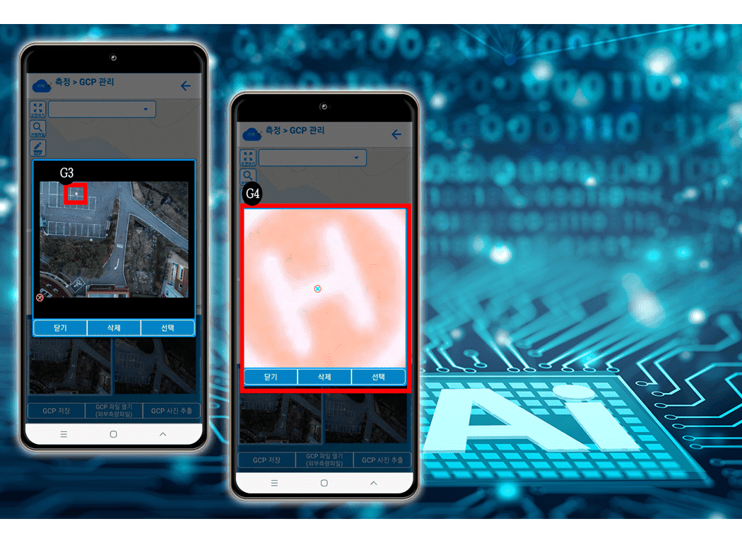
Development and application of
artificial intelligence that automatically models images by
matching images taken by drones with GCP information on maps
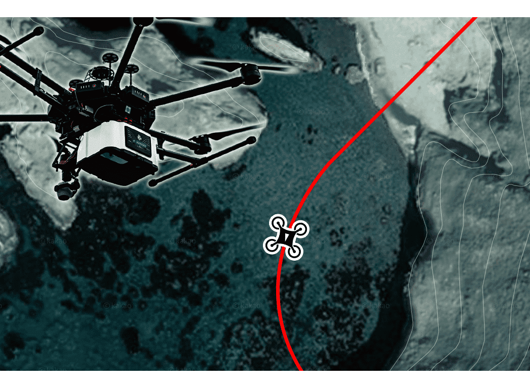
Development and application of artificial intelligence that automatically identifies the surrounding environment and determines and controls the flight altitude of drones
Development and application of artificial intelligence that automatically identifies the surrounding environment and determines and controls the flight altitude of drones
Related Products


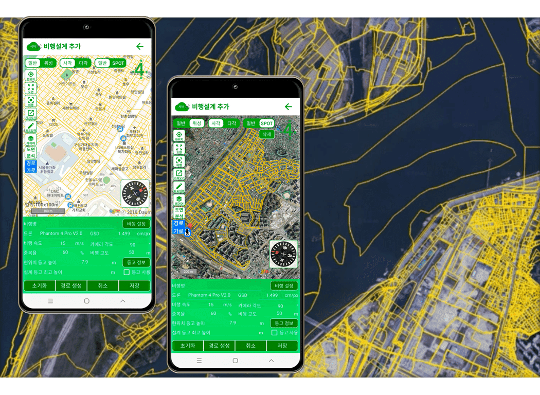
Design technology suitable for
Korean sites enables high-precision
Provides survey function that maximizes user convenience by applying Korea's best AI automation function
Provides survey function that maximizes user convenience by applying Korea's best AI automation function
Related Products

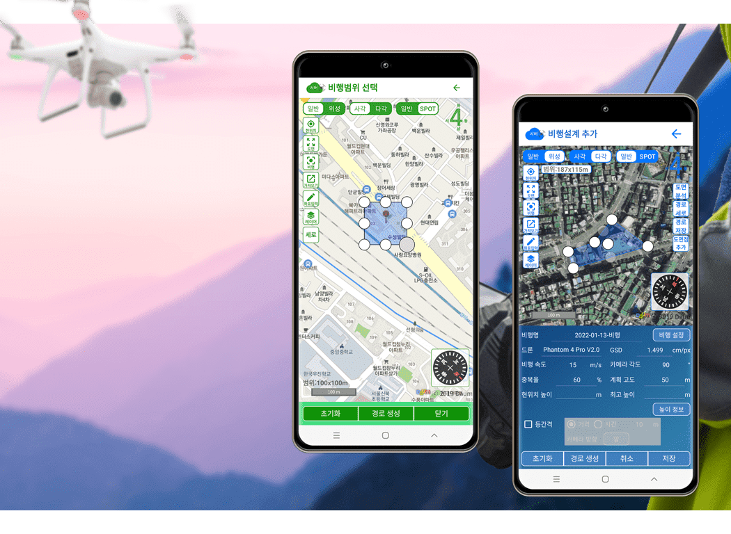
Having flight operation
management functions specialized for Korean drones
Unique patent-certified GCP coordinate automatic matching AI technology provides increased convenience and reduced visiting time
Unique patent-certified GCP coordinate automatic matching AI technology provides increased convenience and reduced visiting time
Related Products
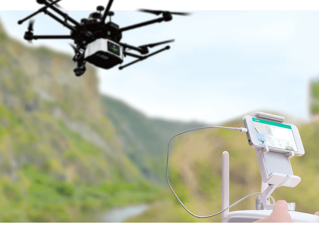
Suitable flight design with LiDAR
characteristics in mind
Accurate flight is possible through patent-based contour flights supporting automatic alignment flight by cabinet flight design
Accurate flight is possible through patent-based contour flights supporting automatic alignment flight by cabinet flight design
Related Products
Curved flight design is possible
for flights that take into account LiDAR characteristics
Designed for stable ground scanning of LiDARs through natural curved flight
Designed for stable ground scanning of LiDARs through natural curved flight
Related Products
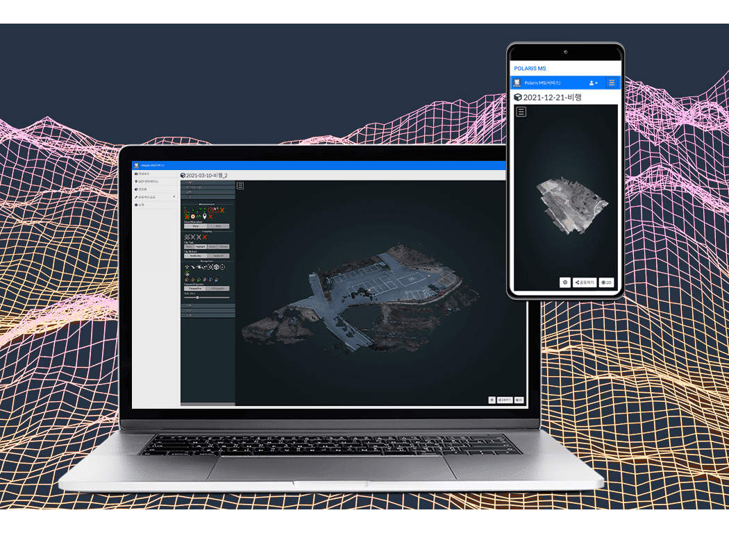
Create 3D deliverables using
proprietary algorithms to easily understand the environment around
the site
All deliverables are stored and backed up on their own servers and ready to use Free to zoom in, out, and rotate, allowing field observation from various angles
All deliverables are stored and backed up on their own servers and ready to use Free to zoom in, out, and rotate, allowing field observation from various angles
Related Products
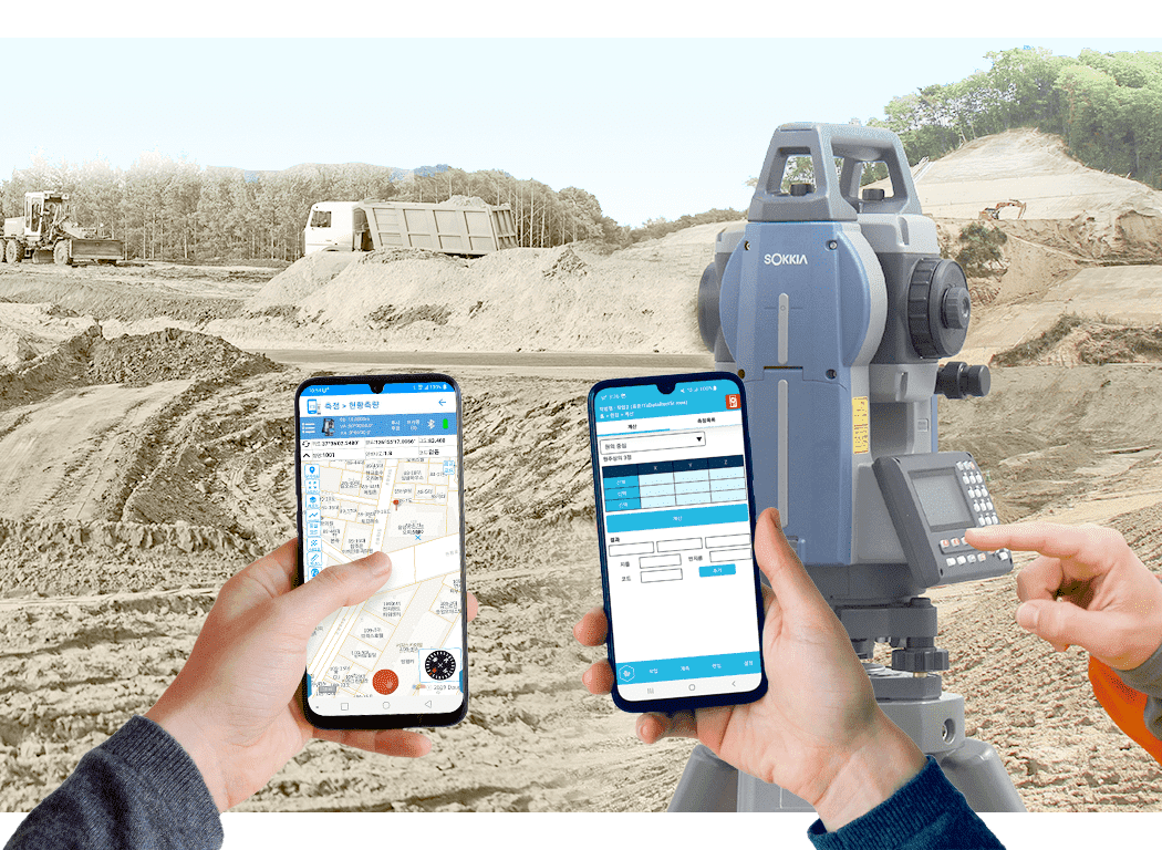
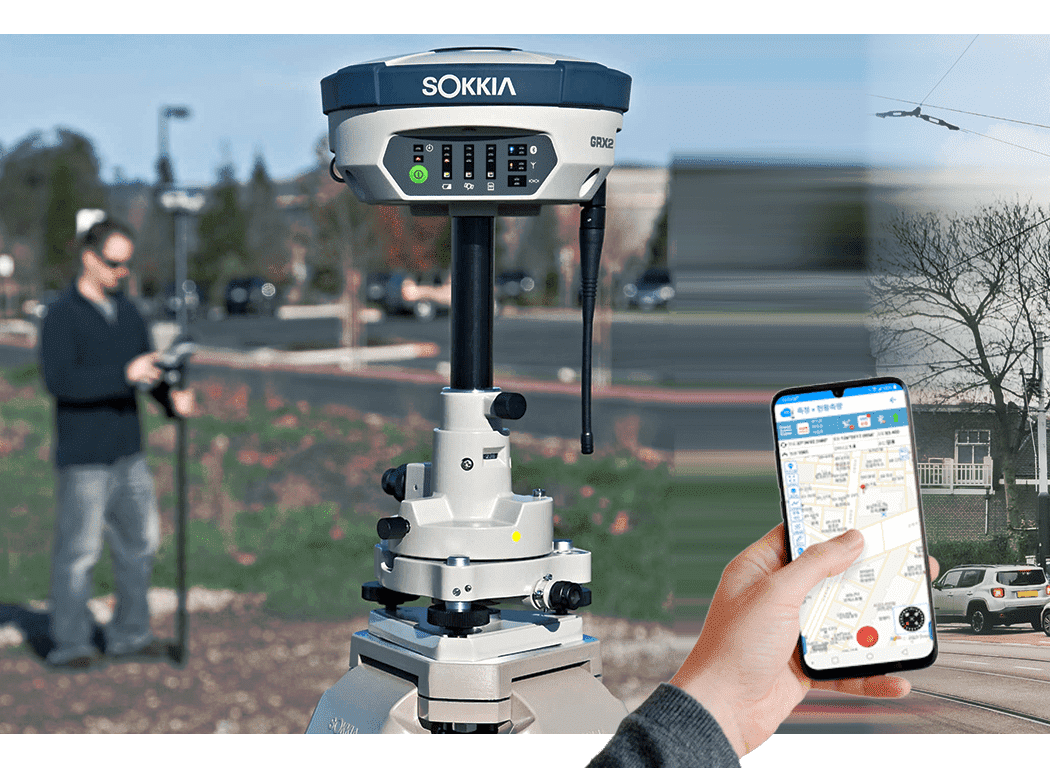
Providing the best measurement
solution with patented technology and reflection of field
environmental conditions
No reconfiguration required with display and regional coordinate interlocking Reduce desk-side visits
No reconfiguration required with display and regional coordinate interlocking Reduce desk-side visits
Related Products

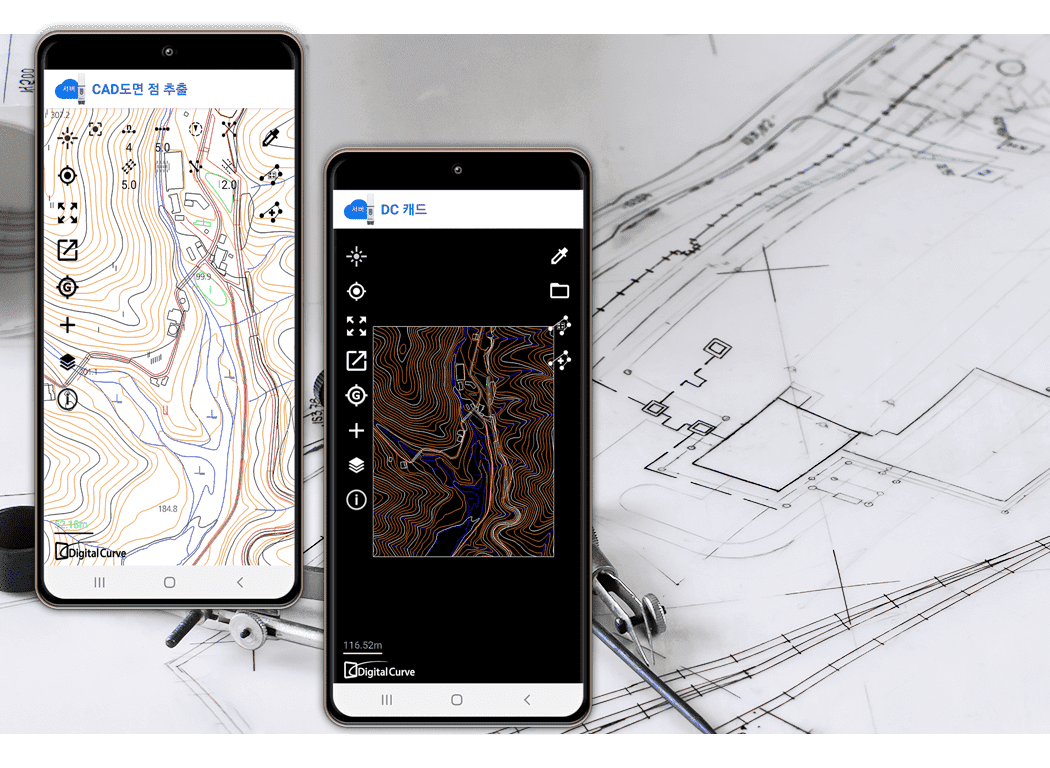
Offer in a variety of apps Basic
functionality makes it easy to convert deliverable files into CAD
drawing files
Read the CAD files Measurement route can be set after drawing application
Read the CAD files Measurement route can be set after drawing application
Related Products

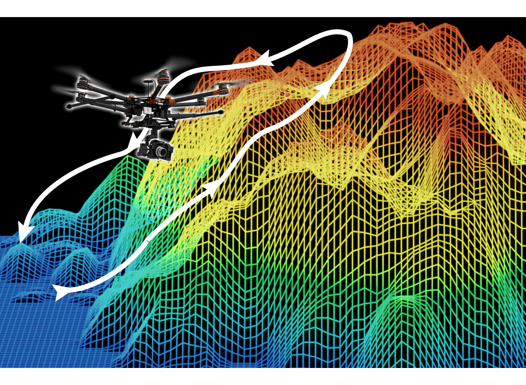
Combines Google Earth (KML) files
with the contents of its own database to determine and control
flight altitude so that drones do not collide
This technology is basically applied to all apps related to drone flight. Flight altitude information modified by the user is generated directly from a user-defined file by referring to DEM information values
This technology is basically applied to all apps related to drone flight. Flight altitude information modified by the user is generated directly from a user-defined file by referring to DEM information values
Related Products
Matching intelligence to drawings
allows for a more detailed view of the field's intellectual state
In addition to CAD drawings, position matching images can be generated by matching land registration maps/drawings using location data of images photographed by drones
In addition to CAD drawings, position matching images can be generated by matching land registration maps/drawings using location data of images photographed by drones
Related Products
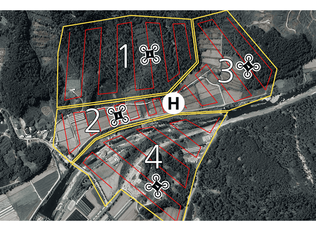
Tailored to the site where a wide
range of drone shooting is required Supports simultaneous group
flight function
When flying multiple drones at the same time, it gives a difference in movement interval and flight height, so that each range can be photographed without any risk of collision without interference with each line
When flying multiple drones at the same time, it gives a difference in movement interval and flight height, so that each range can be photographed without any risk of collision without interference with each line
Related Products